
No 36
No.36

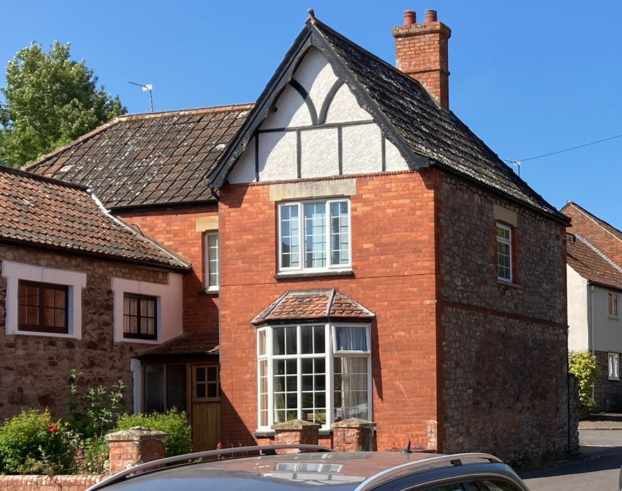
No 36 - As far as I can work out, this house was built soon after the end of the first world war or early 1920s.
It was a major rebuild and extension of a previous single storey commercial building on the site, possibly a workshop or store judging by the doors, although early photographs show no evidence of activity.

photo 1915
The 1750 map shows nothing in this position, but the 1840 Tythe map shows the original building, coloured as non-residential. The original single storey building was therefore built sometime between 1750 and 1840, possibly around the start of the 1800s.


1750 map (left and 1840 Tythe map (right)
In terms of the overall view looking up Castle street, this 1918 rebuild made a major difference, with its change of use, prominent position and with a scale and design quite different from what was there before. The tall forward extending gable with applied timber framing making a clear statement of prominence. The builder or client obviously wanted to make an impression, a long way from the older vernacular scale and style.

Photo from 1926-30
Unusually for this part of Castle street, the house has an enclosed garden section in front. The photo from the 1950s showing that the then occupant made full use of this garden with an impressive show!

Photo from 1950s
....
This page is still under review, please come back to see future additions.
....